Drones For Additional Services In 2023
Having a business plan comes in handy here. One of the best ways to identify potential areas for change is by reevaluating your business plan's SWOT (Strengths, Weaknesses, Opportunities, and Threats) section.
You can take a less structured approach if you don't have a business plan. The important thing is to make changes for the new year based on facts and not gut feelings or guesses. If you need help with this and other drone business issues, keep an eye out for our drone business course coming out at the start of 2023.
Once you have done your due diligence, you may decide the best change to make is to add new services. Many drone pilots, including myself, begin with standard camera drones and add additional UAVs to offer more services. Three common directions to go in are mapping, inspections, and agriculture.
Drones designed for these purposes are typically more expensive than standard RGB camera drones. Thankfully, the work they allow a pilot to do pays more than traditional drone gigs like real estate photography. Drones in this category range from entry-level enterprise systems that will run you just under $10,000 to a hundreds of thousands of dollars. I'm going to stick with the low end of the enterprise scale so we can see where the starting point is. If you are looking for more recommendations, book some time to speak with one of our experts!
So, here are my recommendations for drones that support mapping, thermal inspections, and agriculture.
Mapping
Before jumping into my recommendation for mapping, it is essential to mention accuracy. If you have a standard camera drone, you can easily create maps. I used to create 3D maps for clients with my old DJI Phantom 4 (the original version). Generating maps is very easy if you use a mapping program like DroneDeploy. So, why pay thousands when you can create maps with less expensive drones?
While your standard camera drone may create a good-looking map, it will not be accurate. This is especially true if you are looking to map projects for the construction industry or surveys. To be accurate, you need a drone that uses RTK or PPK. I won't get into the specifics here but think of these as a way to calibrate the images your drone collects, so they are accurate. With the right equipment, a drone can produce maps with cm-level accuracy.
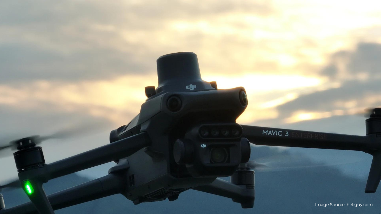
My pick for adding mapping services in 2023 is the DJI Mavic 3 Enterprise. This drone is portable, has a 4/3 CMOS Wide Camera, 56× Hybrid Zoom, 45-minute flight time, and with the DJI RTK module, can produce centimeter-level positioning.
If you're interested in the Mavic 3 Enterprise, I recommend also buying the RTK module (if not included with the drone), the battery kit, DJI D-RTK 2 Base Station Tripod, and the DJI D-RTK 2 high precision GNSS mobile station. The whole package will set you back around $8,000 to $9,000, but you'll have everything you'll need to add mapping to your services.
Thermal Inspections
Thermal imaging is in high demand these days. Utility companies, in particular, are reaping the benefits of drones with thermal cameras, but others are using the technology as well. When looking for a thermal drone, it is important to understand resolution and whether or not the drone's thermal camera is radiometric.
Without getting into too much detail, some thermal drones don't have high enough resolution to conduct inspections. I have a Parrot ANAFI thermal that is a great little drone, especially when it came out, but the resolution is too low for most work. At best, I can inspect a roof for heat leaks. I definitely cannot inspect solar farms or wind turbines using this UAV.
Lower-end thermal cameras take a snapshot of the temperature, whereas radiometric thermal cameras record a temperature for each pixel in the image. No one will want thermal inspection with anything other than a radiometric camera. It makes a huge difference when reviewing the data after your flight.
If thermal inspections are worth adding to your services in 2023, consider the Autel Robotics EVO II Dual 640T Enterprise Bundle V3. The thermal camera on the 640T is radiometric and has good resolution. Like the Mavic 3 Enterprise, it is a highly portable and folding drone.
The enterprise bundle includes everything you will need. The bundle is $7,000 and has the drone, hard case, multiple batteries, attachments like a speaker and flood light, a remote with a large screen, and more.
Agriculture
Precision agriculture is big business. Last month, according to the United Nations, we crossed over to a global population of more than 8 billion people. That's a lot of mouths to feed. Unfortunately, there isn't enough arable land for growing all that food. Unless we get smarter about farming with the land we have, we are heading for a disaster.
Multispectral drones can provide farmers with a wide array of information to make growing more precise. Soil content, water usage, certain plant diseases, and more can be determined just by flying a multispectral drone over a field or orchard. The cost of using drones for this purpose is often many times less expensive than manual methods of collecting the same information.
If you live in an agricultural region and want to add this service, take a look at DJI's new drone, the Mavic 3M. This $4,200 drone is portable like all Mavic 3 series drones, has four 5MP G/R/RE/NIR cameras, a 20MP RGB camera, a 15km transmission range, and can cover 200 hectares (just shy of 500 acres) in a single flight.
So, if the new year looks like new services for you, consider these drones or ask one of our experts for their advice. Stay safe out there, and happy flying!
Article Written by David Daly

Join Our Private FB Group Community
Access to training, education and drone industry news. Meet other like-minded drone enthusiasts, just like you!
Online Part 107 Test Prep Course | Sale
Recent Posts
